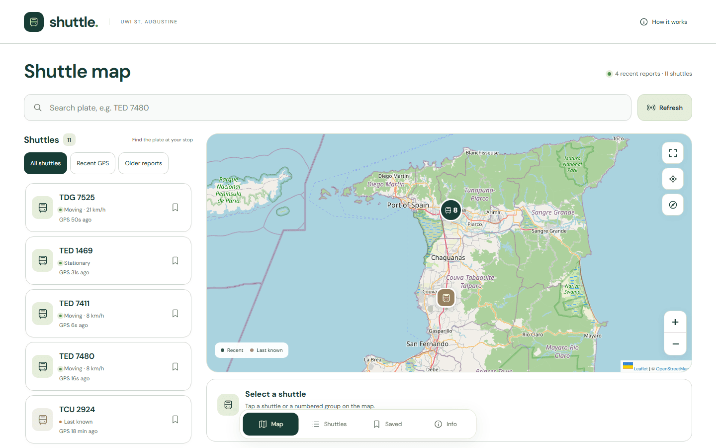
I rebuilt and shipped a shuttle map for students at The University of the West Indies (UWI), St. Augustine. The previous tracker was no longer maintained and did not work on newer Android versions. Moving the experience into the browser gave students a way to check shuttle positions on modern phones without depending on the old Android app.
Start with the map
The tracker opens directly onto an interactive map and a searchable shuttle list. Students can select a vehicle on the map, expand a numbered group, or search for the plate displayed at their stop. The same selection connects the map to that shuttle's details.
On phones, the map remains the main workspace, with dedicated views for the shuttle list, saved vehicles, and information. A fullscreen map and location controls help students orient themselves without crowding the smaller screen.
Show how recent a position is
A marker is useful only when its age is clear. Each shuttle shows the age of its GPS report, and the interface distinguishes recent positions, older last-known positions, and vehicles with no GPS position. Filters make those differences easy to inspect.
The feed refreshes every 30 seconds while the tracker is open, with a manual refresh action available too. GPS freshness is kept separate from whether a shuttle is in service: students match the plate to the route shown at their stop, rather than relying on an unsupported arrival countdown.
Make the next visit easier
Students can bookmark shuttles and return to a saved list. Plate search, vehicle selection, and shareable shuttle links make it easier to check a familiar vehicle again or point someone else to the same shuttle.
The frontend uses Leaflet and OpenStreetMap for the map, with browser-based interaction controls and a server-side feed integration. Loading, unavailable-feed, and empty states keep the interface understandable when a tracker is quiet or a connection fails.
Rebuild around everyday use
The goal was to restore a practical student tool and make its information easier to judge. A browser-based release removes the dependency on the old app's Android compatibility, while clear GPS ages help students understand what the map can tell them.
This is an independent student tool. A connected tracker does not necessarily mean a shuttle is operating, and a last-known location does not guarantee an arrival time.